I do most of my longer hikes solo in the Swedish mountains, where cell reception is scarce and you can sometimes go days without meeting another person. For my own physical well-being and the mental well-being of my loved ones, I always bring my Garmin InReach Mini. The InReach Mini is a satellite communication device with GPS which you can use to send text messages, call for emergency services, track your hikes, navigate outside of cell reception, and request weather forecasts for your current location.
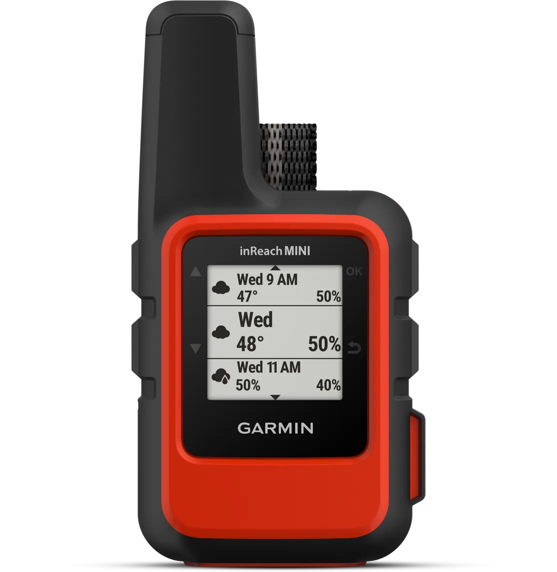
I bought my InReach Mini in 2020, ahead of my first solo hike in the Swedish mountains: nine days from Abisko to Nikkaluokta, partly following the Dag Hammarskjöld pilgrimage trail. It’s been with me on every hike in areas without cell reception since, including my thru-hike of the Swedish mountain chain in 2023. The InReach Mini has a tiny 0.9 inch (23 mm) black-and-white screen, large buttons for navigating the interface that are easy to use with gloves on, and a dedicated SOS button hidden beneath a lid so you don’t press it by accident.

The InReach Mini weighs about 100 grams and has a rugged, rubbery housing with IPX7 waterproof rating. I keep it attached to my backpack shoulder straps so it’s always close at hand, and it’s been through plenty of rain storms without issues. I own the first generation InReach Mini, which has a FireWire charging port. The second generation has a USB C port and slightly improved battery life.
The interface on the InReach Mini is easy to navigate once you get used to it, but there’s only so much you can do with a 1 inch screen. Thankfully, Garmin has a smartphone companion app called Earthmate. With it, you can read and send messages, see your routes and waypoints on a map, request weather forecasts, send an SOS, and do pretty much everything else you can do on the device itself. The app communicates with the InReach Mini over Bluetooth.
Since the InReach itself relies on satellite communication, you need to have a clear view of the sky to use it. It can take a while in cloudy conditions. I’m yet to experience weather bad enough that the signal fails to go through entirely, though. For the satellite communication to work, you need a monthly paid subscription. Without it, the InReach is just a very expensive paper weight. The features and pricing of the different plans changes too often for me to go through them in detail here, but if you only want to be able to call for emergency services and maybe send a text message or two, the least expensive plan will be fine. It currently costs around $12 per month. You can pause the subscription between hikes without losing your data.

Battery life is pretty key for a device you’re counting on for emergencies, and the InReach Mini does a good job here. For my two month thru-hike of the Swedish mountains, I used the InReach to register a daily waypoint, send a few text messages, and request weather forecasts every now and then. In those two months, I didn’t need to recharge it once. If I remember correctly, the battery was still at ~40% when I finished. The battery will deplete quicker if you keep it on during the day to track your route, but most people won’t need to recharge it during a hike. Garmin says that it will last you 24 days in battery mode when set to 30 minute tracking intervals.
I don’t have any experience with other GPS tracking devices or emergency beacons, so I can’t speak to how it stands up to the competition. To the credit of the InReach Mini, I haven’t really seen any reasons to try anything else. Since I started hiking, I’ve replaced most of my hiking gear once or twice because I wore it down or wanted something lighter, but the InReach Mini is lighter than most competitors and still works fine despite being six years old. I doubt I’ll replace it before the battery dies on me. When I do, its replacement will probably be the second generation InReach Mini.
For a more detailed walkthrough of all of the hardware and software features in the Garmin InReach Mini, see this excellent review by HikingGuy.


