On July 31 last year, I set up my autoreply, reviewed my pre-hike-checklist for the third time, took a cab to Stockholm Central Station and got on the northbound night train.
My destination was Abisko, a small town in the far north of Sweden and the starting point for the King’s Trail. The King’s Trail (Kungsleden in Swedish) is a 440 kilometer (270 miles) hiking trail following the Swedish mountain chain from Abisko in the north to Hemavan in the not-quite-as-north. After two seasons of shorter hikes, I had decided that I was ready to solo hike the King’s Trail. It was the only thing on my calendar for August 2021.
During the hike, I wrote daily updates on my Instagram account and published them when I had reception. This summary of the hike is mostly based on those updates, along with a diary I kept in Swedish while on the trail. Writing helps pass the time, and you have a lot of free time when you’re solo hiking. I have some fun adventures planned for the 2022 hiking season as well, so if you want to tag along, feel free to follow me.
If you want to see what I brought along on the trip, you can find my Lighterpack list here. You can find more information about the King’s Trail, including a map, on the Swedish Tourist Association website.
August 1 (27.4 km)

I straightened out my back after 17 hours on the night train from Stockholm to Abisko, did the ceremonial weighing of the backpack (13.4 kg), and had lunch in the restaurant at Abisko mountain station. It was finally time to head off on the 440 kilometer long King’s Trail in the fjäll of northwestern Sweden. Despite the weather forecast predicting a cold and cloudy start to the trip, I was itching to get going.

The first section of the King’s Trail takes you into Abisko National Park, with a beautiful, deep canyon with rushing water to your right as walk away from civilization and into a birch forest with mountains on all sides. I posted a final message on my Instagram account before I left. When you enter the park, you quickly lose your cell reception, and spend the next four to five days in the radio shadow of the Kebnekaise mountains.


After a couple of hours, I reached the first Swedish Tourist Association (STF) cabin by the shore of the lake Abiskojaure. The cabins are manned and some have small shops, which means that you can refill your backpack with food and other necessities along large parts of the King’s Trail.
My backpack was already fully stocked with food since it was my first day on the trail, so I only picked up one thing from the shop: a cabin patch. Each STF cabin has a unique patch that you can buy from the cabin host. I had decided that I would try to collect a patch from every cabin I would pass on the hike. The collection would make for a fun memento from the trip, and it would give me an excuse to stop and chat with the hosts at every cabin on the trail.

After a short breather, I left the Abiskojaure cabins behind and returned to the trail. Sweden has something called Allemansrätten, which gives you right of way and the freedom to pitch your tent almost everywhere. Some nature reserves and all of the national parks are excluded, which meant that I had to leave Abisko National Park behind before I could pitch my tent.
After a couple of kilometers of climbing towards Alesjaure, I had followed the trail out of the park and had a beautiful view over Abiskojaure behind me. I was happy with my first day on the trail and ready to start looking for a place to pitch my tent for the night.
That’s when I fell on my face.

A hook-shaped bush root was sticking out into the trail, and my left boot caught it. I managed to raise my hands to my chest before I hit the ground. A rock gave me a bad scratch on my chin, and I got some pretty ugly bruises on my chest (that I didn’t notice until days later), but I was still incredibly lucky. A poorly placed rock could have smashed my teeth in and ended the hike right there, a couple of hours after I got off the train. This would have been a much shorter blog post.
Instead, I found a nice place to pitch my tent by the lake Àhpparjávri and got ready for the night. I promised myself to be more careful in the days to come.

August 2 (39.4 km)
I woke up feeling rested and excited, and I could barely feel the scratch in my face from the previous day. I broke camp early in the morning and started following the shore of lake Alisjávri towards the Alesjaure cabins, which are on a hill on the southernwestern shore of the lake.

Alisjávri, Alesjaure – same name, but spelled differently. Why? The former is the original Sámi spelling, and the latter is the Swedishified spelling. As a rule, Swedish maps today use the Samí names for locations in the Swedish mountains, but the STF cabins still use the Swedish spellings for the most part.

The walk along the emerald green lake was beautiful despite the rain and wind, but I was happy to take a break in the Alesjaure cabins when I reached them around lunch. By the time I had purchased a cabin patch and finished some food and coffee in the warmth of the main cabin, the clouds had started to give way to a little bit of blue sky and sunshine. Hiking in 8° C when it’s windy and raining: not fun. Hike in 8° C when the sun is out, and the kilometers fly by.


After a couple of hours of steady ascent, I reached the Tjäktja cabin, the highest cabin on the King’s Trail at 1020 meters above the sea. I had another cup of coffee before I visited the cabin host to buy a cabin patch and chat for a bit. He told me that a snow storm had passed by in late July, and on his phone, he showed me a photograph of the cabin covered in snow. The weather in the Swedish mountains can be difficult, even in the middle of summer. I counted myself lucky that the thermometer at Tjäktja showed 5° C during my visit.

I continued up to the rocky Tjäktja pass, another 120 meters of elevation and the highest point on the King’s Trail at 1140 meters. I had considered pitching my tent for the night just before the top of the pass, but I was still feeling pretty fresh and decided to keep going.

The view from the pass into the green Tjäktjavagge valley 300 meters below was spectacular. I sat by the Dag Hammarskjöld meditation site and watched the river I would follow on day 3 and 4. It stretched out for 15 kilometers before it disappeared behind the Mádir mountain halfway into the valley.
Assuming my day had peaked, I walked down into Tjäktjavagge to find a good spot for the night. Half an hour later, the sun burst through the clouds between the mountains to the northwest and a complete rainbow appeared next to the trail. Me and a group of hikers that had set up their tents nearby stood in awe for minutes, until the sun dipped below the Geargeoaivi peak and the rainbow disappeared again.

There’s magic in these mountains, I tell you.

August 3 (23.2 km)
My goal for day 3 was simple: sleep in, and walk short. I woke up at ten after eleven hours of sleep, already halfway done with my goals for the day. Day 2 was long, had some decent elevation and my body wasn’t quite in trail shape yet. I was pretty tired.

I made my way south through the valley I had seen from the Tjäktja pass the day before, and soon reached the Sälka cabins, one of the prettiest cabin sites in the Kebnekaise mountains. The Sälka cabins rest on a hill in the middle of the valley, surrounded by dozens of small streams fed by the snowmelt coming from the mountains towering over the valley to the north, east and west. It has an Edoran feeling to it, for you Lord of the Rings folks.
I picked up my cabin patch and some snacks from the Sälka cabin store, and spent an hour relaxing and chatting with other hikers. The cabin was busy with activity.

The weather had improved a lot over the previous day. As I left Sälka behind and continued south towards the Singi cabins, the wind eased up and the sun came out. I could wear shorts and t-shirt for the first time since I got on the train in Stockholm – although I think I was pretty much the only hiker in the valley who did. When I reached the Singi cabins late in the afternoon, the thermometer showed ten degrees. I picked up another cabin patch and continued on my way.


Leaving the Singi cabins heading south felt special to me. When I hiked here in August 2020, this was where I turned east towards Kebnekaise mountain station and Nikkaluokta, where that hike (on Dag Hammarskjöldsleden) ended. This year, I continued south on the King’s Trail. From here on out, every place I visited would be completely new to me.

I pitched my tent next to the river a couple of kilometers downstream from the Singi cabins. Dinner was a freeze dried chili stew with reindeer sausages, which I ate together with a special treat: a can of beer I had picked up in Singi. I went to bed feeling like the real adventure was about the begin.

August 4 (35.8 km)
On August 4, I turned thirty years old. It was my second birthday in a row spent in the Kebnekaise mountains, which has less to do with me being scared of growing old and more to do with August being a really nice month for hiking in the Swedish fjäll.
Still, things like that require celebrating, even when you’re half-sitting-half-lying-down in a tiny tent on a fjäll moor. That’s why I carried a bottle of champagne in my backpack for the first 100 kilometers of the hike. I was also birthday gifted a bag of freeze dried Crema Catalana for dessert ahead of the trip. Thank you, Åsa, Jörn, Anna and Jocke!

Before I had champagne and Spanish desserts, I also walked for a bit. The day started off cold and rainy, so when I reached the beautiful Kaitumjaure cabins around lunch, I paid for a cabin day pass so I could warm up and dry my clothes by the stove in the main cabin. I shared the warmth of the cabin with seven Germans. Due to Covid restrictions, the Swedish mountains had been unusally empty of international visitors in 2020. In 2021, they were back in force.

The weather cleared up a bit while I waited for my clothes to dry, which made my afternoon hike up to the moor towards the Teusajaure cabins much easier and prettier. The descent down to Teusajaure is very steep. My knees don’t get along well with steep descents, so I was in dire need of a break when I reached the cabins. Thankfully, the cabin hosts had a jug with free lemonade at the ready.
Teusajaure is the first lake on the King’s Trail that you cross by boat. You can either pay the cabin hosts to take you across in a motorboat, or make your own way across in a rowboat. I’m that special kind of lazy that doesn’t mind walking for hundreds of kilometers in the mountains, but will happily pay to save myself from rowing while I’m there. I paid for the motorboat, and when it left the dock, I was immediately glad I did. Speeding across the water after five days of hiking was exhilarating. The only downside was that the ride was over so quickly.


With me in the boat were two other King’s Trail solo hikers: one from Italy, and one from Switzerland. We kept each other company as we climbed the 500 meters of elevation from the shore to the top of the moor towards Vakkotavare, where me and the Italian made camp while the Swiss hiker – a ultra marathon runner, so no stranger to long distances – continued to the cabin.


From the moor between Teusajaure and Vakkotavare, we could see the peaks of Sarek National Park to the south and the majestic mountain Áhkká to the southwest. Add a bottle of champagne and a bag of Crema Catalana, and you have pretty memorable birthday celebration.

August 5 (10.3 km)
The fifth day on the King’s Trail saw me reach Saltoluokta mountain station, the end of the first section of the trail and the start of the section to Kvikkjokk, about 60 kilometers away. It seemed like a good time to take a rest day.

The day started with a very steep five kilometer hike down to the Vakkotavare cabin, where the King’s Trail takes a 30 kilometer break. From the cabin, you take the bus to Kebnats, and then the boat M/S Langas to Saltoluokta on the other side of the lake Stora Lulevatten. I arrived at Vakkotavare a bit early, so I had a bit of lemonade and a chat with the cabin host while I waited for the bus. He gave me some terrible news: They were all out of cabin patches!
I had bought all of them up to that point, and was planning on buying the rest of them as I continued south, but without Vakkotavare, my King’s Trail collection wouldn’t be complete. The cabin host gave me permission to try to buy one online when I got back to civilization, but as I write this blog post, I still haven’t. Me and my girlfriend are planning on hiking the Padjelanta trail in summer 2022, and we’ll pass Vakkotavare by bus on the way back. I hope I’ll be able to pick one up then.

While waiting for the boat in Kebnats, I spoke with two Americans who were also thruhiking the King’s Trail. One of them suffered from chapped lips, and he asked me about the lip balm I was using. I told him that the Saltoluokta store would probably have them in stock, and recommended he pick one up there.
Little did the three of us know that we would spend most of the last week on the trail together. When we first met, I didn’t even catch their names. Formal introductions are not common on the trail.

In Saltoluokta, I enjoyed a shower, getting to wash and dry my clothes, a three-course dinner (reindeer was on the menu, of course), browsing the mountain station store and having lots of cups of coffee in the café. I spent the night in one of the upstairs rooms of the charming main building, built in 1918.
I also had cell phone reception for the first time since I got on the trail, so I had a belated birthday video call with my parents and siblings while I watched the sun set over Stora Lulevatten. It was a nice way to end the first section of the King’s Trail.

August 6 (28.1 km)
After good food, good company, eight hours of sleep in a proper bed and a much-needed shower, I left the comforts of Saltoluokta mountain station behind and started the second stage of the King’s Trail. I had an extended breakfast with a northbound hiker from Amsterdam, Kelly, who told me that I wouldn’t have any issues reaching the Sitojaure lake, 15 kilometers away, before the motor boat left in the afternoon.

I crossed the moor between Saltoluokta and Sitojaure with John Denver in my headphones, trying to drown out the strong headwinds without success, but as always, he put me in good spirits. Denver sang about the Rocky Mountains and the Shenandoah River. I think he would have approved of Sarek and Stora sjöfallet as well.

I ended up having a little bit of trouble reaching Sitojaure in time after all. I took a short detour to the Sitojaure STF cabins to pick up a cabin patch. While there, I asked if the motor boat across the lake left at five or six. Five, the cabin host said, and also told me that the driver wanted you to be there more than 15 minutes before takeoff. The time was 16:40. Of course, the credit card reader took an eternity to boot up. I was just about to offer her a 100 kronor bill with the change donated to STF when the card reader started working. The time was now 16:45.
I ran the 300 meters to the pier and arrived ten minutes before takeoff. I got on the boat without issues, thankful that I made it in time but stressed out and worried about my feet. These feet might be made for running, but my heavy Lundhags hiking boots are most definitely not.

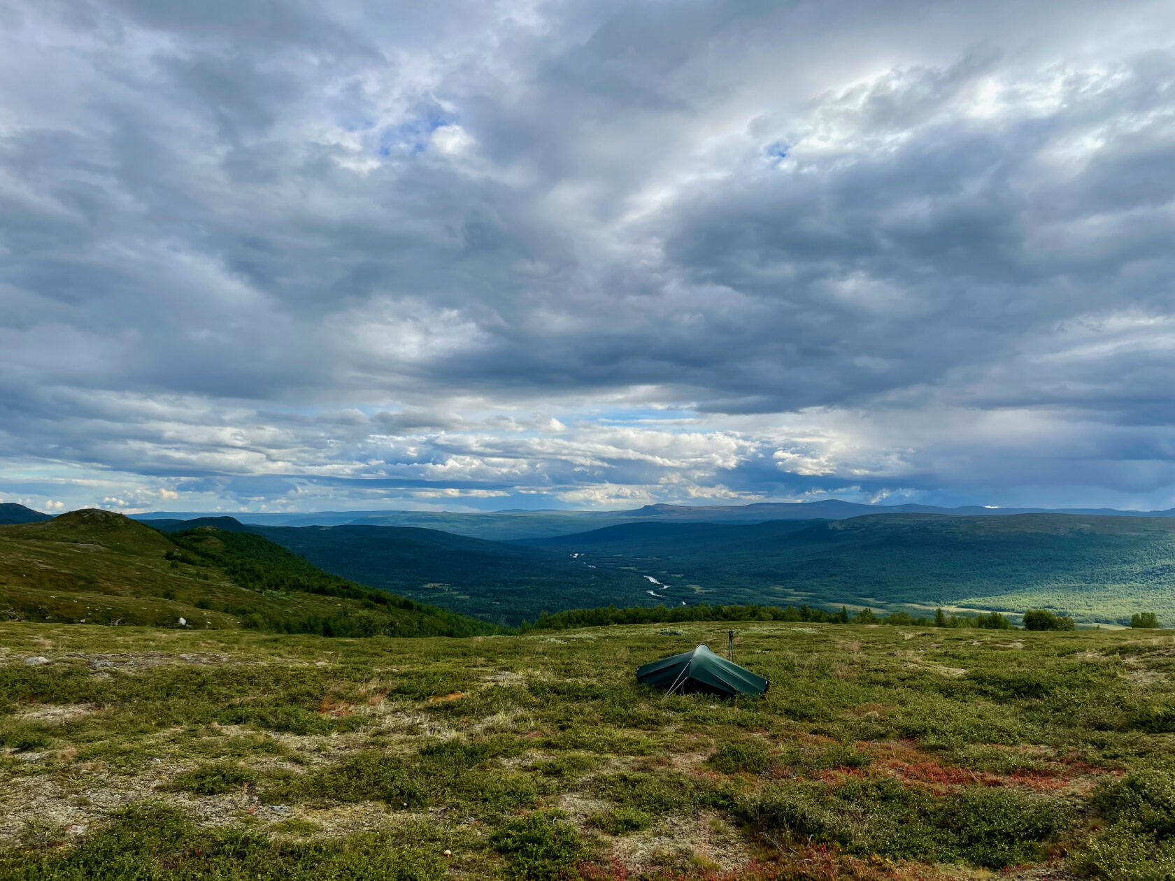
After a fast and curvy boat ride across Sitojaure, I got started on the hike up to the moor towards Aktse. I took a break just above the treeline and started to consider whether I should pitch my tent there or continue a bit further. The first proper downpour of the hike made the decision for me.
I set a personal record in pitching my Hilleberg Enan tent, and just when the tent was up, the rain stopped. That’s when I realized that I had picked a pretty dull tent site. I took it down again, walked 300 meters higher up on the moor, and put it back up. Now with a stunning view over Sitojaure, and with half as many mosquitoes.

There had been some dark clouds overhead in the afternoon, and during the boat ride over Sitojaure, the Samí woman who drove the boat took a single look at them and said ”Thunder”. Sure enough. Soon after I got in my tent for the night, the rain started to hammer the tent cloth again and thunder was heard over the moor.
The bad weather couldn’t dampen my good spirits. I was excited for the next day.
August 7 (35.8 km)
Between the Sitojaure lake and the Aktse cabins, there’s a detour that almost everyone who hikes the King’s Trail takes. That detour is to Skierfe – a mountain peak 1183 meters above sea level. The western cliff face of Skierfe is almost vertical, and the view you have over the Rapadalen valley and the Laitaure river delta 700 meters below is often called the most beautiful in Sweden.
I woke up early in order to have time to climb Skierfe and still catch the afternoon boat from the Aktse cabins over the Laitaure lake. (As you might have guessed by now, ”jaure” is Samí for lake). My day started around 700 meters elevation, just above tree level, and after a pretty steep climb to get up to ridgeline called Njunjes (900 meters), the walk over the moor towards Skierfe was pleasant in the early morning sun.
Going up on Skierfe is an odd experience. The height difference between the peak and the surrounding landscape is only 100 to 200 meters, and since you climb it from behind, you barely notice that you’re close to the peak until you’re standing right on top of it. And then you see the view.

The day had become cloudy, but the clouds were high in the sky and only gave me a greater appreciation for the scale of the view.
To my right, I had the Rapadalen valley stretching in between the snowcapped peaks of Sarek National Park. The Nammatj mountain looking like a dropped pebble in the middle of the valley. Below me, the glacier green water that had carved a river delta with snakelike paths over thousands of years. To my left, the Laitaure lake, and beyond it, the Tjaktjajávrre lake, and far beyond that, I could just make out the Skálkká lake, 50 kilometers away.

I know that it’s a cliché to say that you were overwhelmed by a view, but clichés exist for a reason. I sat down for almost an hour and tried to take in the landscape below. Almost as enjoyable were the faces of other hikers who reached the peak and started laughing as their toils were rewarded with the view.

When I had had my fill of the view, I put my pack back on and started the hike to the Aktse cabins, some eight kilometers to the east and 650 meters below me. I took another short break on the way, and had enough phone reception that I could check the weather forecast. It looked like it would turn pretty foul in a couple of days. I decided to book a room at the mountain station in Kvikkjokk that I planned on reaching two days later, so I would be able to dry my clothes before continuing south.
I got to the Aktse cabin with time to spare before the boat ride, so I browsed the cabin shop, picked up a cabin patch and chatted a bit with the other hikers before we got on the motor boat at five. The view up towards Skierfe and Nammatj was almost as stunning as the view from the peak.


The pretty views continued as me and two of the other boat passengers carried on up to the moor southwest of Tjahkelij, from where we could see the late evening light over the Tjaktjajávrre lake to the east. I made camp by the Jågge shelter, tired but happy with the day.

Skierfe had been described as a highlight of the hike by almost everyone I had talked to. Having been there felt strange, as if the hike hadn’t felt quite real until I reached Skierfe. I also felt a bit sad. The stretch between Saltoluokta and Kvikkjokk was the section I had been the most excited for, and now that it was coming to a close, I realized that I wasn’t as excited for the two stages in front of me: from Kvikkjokk to Ammarnäs.
If I ever had any doubts about whether I would complete the hike, it was now.
August 8 (24.8 km)

After sleeping in for a bit, I left the moor behind and continued south into the forests north of Kvikkjokk. I was a little worried that I would find the forest trails dull after being spoiled by views the last few days, but it was actually a welcome change of scenery – even with the rain arriving in the afternoon. Finding the first ripe cloudberries of the hike definitely didn’t hurt.


I took a quick break at the Pårte cabins to pick up a cabin patch and rest my feet for a bit. This was probably the first time I had a poor experience with a cabin host. He wasn’t downright hostile, but the vibe I was getting from him was ”And what do you want?”, like I was intruding on private property.
I kept going southwest past the Stuor Dáhtá lake and towards Kvikkjokk. After a while, I met a hiker with red hair and beard who asked me about the state of the Jågge shelter. I told him that it had looked alright when I passed it the previous day. The red hair and beard felt familiar, and after a while it hit me: This was Ludwig, one of the Green Ribbon hikers I had followed on Instagram for over a month.

The Green Ribbon is a thruhike of the entire Swedish mountain chain, from Grövelsjön in the south to the Three-Country Cairn 1300 kilometers north, where the borders of Sweden, Norway and Finland meet. I asked Ludwig to pose for a photograph before I let him get on his way. He graciously agreed. He wasn’t the last Green Ribbon hiker I would meet on my journey.
I made camp a couple of kilometers from Kvikkjokk as the rain started to come down harder. I hadn’t hiked especially far, but the rain had dampened my spirits and I felt pretty tired. I was looking forward to a day spent indoors.
August 9 (8.3 km)


After a rainy day and night, and more rain promised by the weather forecast, it was a relief to walk into Kvikkjokk mountain station early in the morning. Reaching Kvikkjokk meant that I had a warm shower, hot meals and a room all my own to look forward to. It also meant that I was done with the second stage of the King’s Trail, with three stages remaining. The dinner was fully booked, but the grilled sandwich and beer I had as a late lunch/early dinner felt like a worthy celebration. That, and being indoors while the rain poured down outside.
I looked at myself in a full-body mirror for the first time since starting the hike, and it was obvious that I had already lost quite a bit of weight. It’s difficult to eat enough while out on the trail, but I did my best to catch up in the Kvikkjokk restaurant. I also noticed that I had gotten pretty sizeable bruises on my chest when I fell on my face on the first day. I should probably count myself lucky that I got off without any broken ribs.

I was grateful for the rest day, but the Kvikkjokk mountain station was a pretty big step down from Saltoluokta. I was staying in the original mountain station building, built in 1928, and it was beautiful. Especially the upstairs common room, with the timber walls, old furniture and the view over the Gamàjåkhå rapids just behind the building.
The main building, with the reception, shop and restaurant, was less nice. It was both messy and dirty, and the lack of common areas when the restaurant was closed led to the lobby being very crowded, with a constant line to the only toilet close by. It felt more like a camping ground past it’s prime than one of the most popular mountain stations in Sweden. They do get some points for playing a Tracy Chapman playlist on the speakers, but I wouldn’t want to spend more time than necessary in Kvikkjokk mountain station.

The mountain station store was pretty cleaned out, but I managed to pick up some more freeze dried food bags. They were all out of bars – my preferred snack while hiking – so I picked up a dozed small bags of nuts instead. It was the final store I would pass before Jäckvik, four days away, so I couldn’t afford to be picky. All in all, two freeze dried dinners, six bags of nuts, freeze dried soup, a cabin patch and some candy set me back 650 kronor. The Kvikkjokk store was way more expensive than the STF mountain cabins, despite being accessible by road. I tried to make up the difference by having about six coffee refills.
The third and fourth stages are supposed to be the most remote and least crowded of the King’s Trail. I hoped that would be an interesting change from the section between Saltoluokta and Kvikkjokk, which was busier than I had expected. I finished my evening in Kvikkjokk with a bottle of local beer and a bag of nuts in the lobby before going to bed.
August 10 (42.5 km)
The first day of stage 3, from Kvikkjokk to Jäckvik, started with breakfast at the mountain station. I’ve been pretty harsh about my stay at Kvikkjokk, so credit where credit’s due: The breakfast buffé was very good. That goes a long way.

After another six cups of coffee, I walked down to the dock to continue my hike. There, me and ten other hikers were picked up by captain Björn for the 3 kilometer boat ride across Saggatjaure. I know I came to the mountains to hike, but the boat rides were a highlight of the trip.


From the south shore of Saggatjaure, it was a four kilometer steep climb to get out of the thick forests and up to where the vegetation started to thin out. From there, it was another eight kilometers to get to the moor and the Tsielekjåkk break cabin. The weather had turned pretty unpleasant, and after an hour in the cabin, most of the passengers from the boat ride had caught up. We did our best to make room for everyone. It was cramped, but warm and dry.

There are no manned Swedish Tourist Association cabins between Kvikkjokk-Jäckvik and Jäckvik-Ammarnäs. To hike those stages, you need to bring a tent and supplies for multiple days, which means that it’s the least crowded part of the trail. I decided to count all of the hikers I met going north during the day. When I set up my tent in the evening, I had passed 18 hikers in 11 hours. A lot fewer than there had been on the northern stages, but still more people than I meet when I hike lowland trails in the middle of Sweden. The fjäll were busy in 2021.
When I left the Tsielekjåkk break cabin and continued the climb uphill, I quickly got surrounded by a thick fog. The view over the forests to the east disappeared, but in exchange, the fog made the moor even more dramatic than usual – like a set for a 1960s The Hounds of the Baskervilles movie shoot. The fog lost its charm when it turned to rain, though.


After I had left the fog and rain behind and got down into the forest in the other side of the moor, I was so happy to be out of the bad weather that I kept walking late into the evening. By the time I started to look for a good place to put up my tent, I was deep in wet and messy birch forests without a suitable tent site for kilometers. The only decent one I did find was already occupied – by a tent of the same make, model and color as my own. In my tired state, it took me a second to realize that it wasn’t mine.


I made camp on the shore of the Piteälv river at nine, and at that point, I was well and truly wiped out. It ended up being my longest day on the King’s Trail, and the second time I had walked longer than a marathon on a multi-day hike. I should have made camp much earlier and walked much shorter. Going to bed, I was worried about how my body would feel the next day.

August 11 (25 km)
I had slept for ten hours that night, and woke up feeling rested considering the previous day. After crossing the bridge over the Piteälv river, I kept going until I reached Tjäurakåtan, a cabin built by the Samí who herd reindeer in the area. I had some soup, a bag of nuts and a strong cup of coffee while I listened to the wind outside. Around 12 meters per second according to the Swedish weather service. The forecast promised me that it could calm down later in the evening.


The eleventh day of the hike included a fun milestone. Later in the day, as I made my way up to the Gásakláhko fjäll, I passed the halfway point of the King’s Trail. It was nice to know that I was closer to the end in Hemavan than the beginning in Abisko.
I also spotted a celebrity on the trail: Ted Weirum, a Swedish hiking YouTuber who passed me heading northbound in a brisk pace. It took me a second to place him, and by the time I did, he was already far away. Later, I learned that Ted was also out hiking the Green Ribbon. You can find videos from his hike (with English narration) on his YouTube channel.

Reaching the halfway point made me realize that I would probably complete the hike. I didn’t bring a second bottle of champagne to celebrate the occasion, but I did get the first few rays of sunshine in four days as I pitched my tent with a view over the Bartávrre lake. After dinner, I had whisky (hiker-friendly casket strength from Nikka) and dark chocolate while I watched the reindeer walking on the moor. It had been a really good day. I had needed a good day.

August 12 (36.8 km)
I woke up in the middle of the night by the sound of my own screams. I don’t remember the nightmare that led to me screaming, but my heart was beating so hard I thought it might burst through my chest. I had to take long, heavy breaths for quite a while before my body started to settle down.
It was three in the morning, and the strong winds were causing the tent cloth to flutter in the wind. I considered going out to check the pitch, but decided to trust my tent and went back to sleep instead. I woke up again four hours later by the morning sun coming up over Båråktjåhkkå.

The day started with a 14 kilometer hike down from the moor to Vounatjviken, for the boat ride across the lake Riebnes. On the way down, I passed a sign letting me know I had left the Arctic circle. The early start was a good joke on me, because when I reached Riebnes at 12, I learned that the afternoon boat didn’t leave until five hours later.
Fortunately, there was a good wind shelter down by the lake, and the family who own the motor boat business also had a small shop with coffee, chocolate and ice cream.


Killing time is an essential survival skill while solo hiking, and reading is my go-to solution. While waiting for the boat over Riebnes, I was reading the fun British mystery novel Thursday Murder Club, and re-listening to the third book in A Song of Ice and Fire. When I grow tired of reading, I hunt mosquitoes. Or check the weather for the tenth time that day. Then I read some more.
Five hours and many chapters of Thursday Murder Club later, 17:00 rolled around and it was time to get on the motor boat. Of the twelve people on board, seven took the same boat as me from Kvikkjokk. We talked about the past few days and the next stretch of the trail during the boat ride over the lake.


After we reached the other side of Riebnes and climbed from the birch forest up to the moor, the benefit of the long afternoon wait made itself apparent: the evening sun hanging low in the west. It almost brought out some fall colors on the moor.


I was tempted to put up my tent on the moor and call it a day, but I felt strong and wanted to make the most of the beautiful evening. I said goodbye to the others and went down the other side of the moor and into the forest. After another five kilometers, I started to look for a good spot for my tent. I couldn’t find any.

I reached a small lake that you have to row across, and hoped there would be a tent site by the wind shelter on the other side, but no such luck. I kept walking, knowing I was getting closer to Jäckvik and that it was quickly getting late, but the kilometers went by without a single decent tent spot in sight.
Around 23:00, I quietly made my way to the far end of the yard of Kyrkans fjällgård camping in Jäckvik, careful not disturb anyone as I set up my tent. It wasn’t the arrival to Jäckvik I had planned, but stage 3 of the King’s Trail was done.

August 13 (18.9 km)
After the late arrival to Jäckvik and Kyrkans fjällgård camping, the first order of business was to pay for the tent site I had used the previous night. The friendly man in the reception told me that it wasn’t unusual that hikers arrive late in the night to set up their tents and pay the morning after. That made me feel a bit better.
In the common room, I found the familiar faces of thruhikers that were in the same boat as me from Aktse a week ago. Two of them had decided to leave the trail in Jäckvik. Too much bad weather, too many birch forests.

The second order of business was the ICA Jäckvik supermarket, which has reached a almost mythological status among thruhikers heading south. “I hear it’s huge!” “Did you know that they have pizza?” “They have a cafeteria with coffee drinks!” On the way there, I had another run-in with the two Americans, who were heading back to Kyrkans fjällgård after their second supermarket trip of the day. One of them had caught a stomach bug, so they had decided to spend two days in Jäckvik before continuing south. I still didn’t catch their names.

The bit about the coffee drinks at the supermarket wasn’t true, unfortunately. I could have used a good cappucino. The vending machine coffee was pretty good as vending machine coffee goes, and other than the lack of coffee drinks, ICA Jäckvik lived up to its reputation. Being able to pick and choose from rows of fully stocked shelves was wonderful.
After filling both my food bags (the one in my backpack, and the one in my tummy), I was ready to leave civilization behind again and start stage 4 of the King’s Trail, from Jäckvik to Ammarnäs.


The previous day had gone long, so I decided to make today a short one. After taking a break in the Pieljekaise cabin 8 kilometers south of Jäkkvik, I continued another 6 kilometers before making camp by lake Luvtàvrre, just on the southern edge of Pieljekaise National Park.
I promised myself I would swim in a mountain lake at least once on this trip, and since it was 19° C and mostly sunny, it seemed like today might be my best chance. Getting in the water without giving off screams that might lead someone to call mountain rescue wasn’t easy, but after a while, I lost the sensation in all my limbs and was free to enjoy the swim.

August 14 (32.4 km)
After 8 kilometers of birch forests in the morning, I reached Adolfström. Adolfström is a small town on the shore of lake Iraft, founded in the 1700s to facilitate the Nasa silver mine to the northwest. The mine was shut down in 1810.
Today, the town mostly sustains itself on tourism. One of the main attractions is Adolfströms handelsbod, a small shop with a cafe and a large collection of curiosities from the mid-1900s. I was excited to visit it. The thought of a cup of coffee and waffles (and ice cream, and chocolate) in the sun put a spring in my step as I entered Adolfström.

When I got to the shop, it was closed.
I consoled myself with a bar (date-cashew-almond-banana) by the town docks before I continued along the shore of Iraft to Bäverholmen, where I knew there was a camping and a restaurant. Fortunately, Bäverholmens värdshus wasn’t closed. The brown trout with boiled potatoes was the best thing I had eaten since I got off the train in Abisko.


The forecast predicted cold weather in the days to come, so I tried to make the most of the evening sun. After I left the birch forests behind south of Bäverholmen, I took my time as I made my way south across the Sjkälttjágelias moor towards the Sjnulttjie cabin, and finally made camp at eight in the evening on a hill between the lakes Plássuoke and Stårbmiejávrrie. Yes, I am getting a kick out of typing out all these names.

August 15 (25.3 km)
Hello Västerbotten! On the 15th day of my hike, I left Norrbotten county behind and walked into Björkfjäll and Västerbotten, my old home county and the home county of my fathers side of the family. I was so excited about this milestone that I walked for three to four hours without break in the morning until I reached the blue sign marking the border between the two counties.
The distances become more real when you realize that you’ve walked (and taken the bus for 30 kilometers, and a few motor boat rides – but still!) from Abisko in Norrbotten to the northern county border of Västerbotten. It was one of the most satisfying moments of the hike.

Excited but tired, I sat down on the moor for two bars and two and a half cups of coffee. Half, because I managed to tip over the last cup while filming for an Instagram story. A sacrifice to the social media gods. The break stretched on for an hour and a half. It’s easy to remain seated when you’re on a beautiful moor and it’s sunny, reasonably warm, and not too windy.


I remained in good spirits as I continued across Björkfjället towards Ammarnäs. The next point of interest was the Rävfallsstugan cabin down in the valley below, and I considered going there and then continuing up to the moor on the other side. That would have added ten kilometers to my day, though, and I didn’t see the need to do a 35 kilometer day since I wasn’t planning on reaching Ammarnäs until two days later.


Besides, it was pretty easy to convince myself to stop early, since I found a perfect tent site just above the tree line, five kilometers from the Rävfallsstugan cabin. From there, I could see the valley below and the Vindelälven river disappearing behind a ridgeline. On the other side of that ridge, hidden just out of sight, was Ammarnäs and the end of the fourth stage of the hike.

August 16 (27.7 km)
Given that I almost could see Ammarnäs the previous day, it felt strange to start day 16 by walking away from it. The King’s Trail makes a U-turn to the northwest before Ammarnäs, over the Vindelälven river down in the valley and then up on Ammarfjället, from where it follows the ridge of the moor southeast for 15 kilometers until it reaches Ammarnäs.


The trail down from the moor where I had made camp the previous day was wet and steep. When I reached the Rävfallsstugan cabin by the Vindelälven river, I stopped for an extended breakfast break with lots of coffee. The thermometer in the cabin told me that the outdoor temperature was 12.9° C.
Before I started the climb up to the moor on the other side of the valley, I took a moment on the bridge over the Vindelälven river. If you follow Vindelälven downstream for 440 kilometers, it joins the river Umeälven, which passes through the city of Umeå before reaching the ocean. I went to university in Umeå and lived there for five years before moving to Stockholm. I have countless memories of walks along the river, eating dinner on the restaurant boat Båten, riding a bicycle with friends over the Tegsbron bridge, having lunch on the docks by Strömpilen, and so on.
Standing on the bridge over Vindelälven, I felt all of those memories wash over me. It made my emotional in a way I hadn’t anticipated and couldn’t explain.

The moor north of Ammarnäs peaks at 926 meters above sea level on Stourajåbba, and the 360 degree views of the surrounding mountains are worth the detour. Even when those mountains are shrouded in low-hanging rain clouds, like they were today. Even when you also have rain clouds above you. The bad weather promised by the forecast had caught up with me.
I took cover in the Stabburet shelter next to the trail, together with an Italian couple who were also southbound on the King’s Trail. They had been there for a while, and left just after I arrived. Being indoors twice in one day felt luxurious.

When I left the shelter, I met a group of three people sitting on the steps outside. Maybe they preferred not to share the shelter, the times being what they are. We talked for a bit, and they mentioned that they hade changed their schedule to avoid the weather on Wednesday, two days later. I raised an eyebrow and checked the forecast. The weather service expected 32.7 mm rain on Wednesday.
After considering my options, I decided to stay for two nights in Ammarnäs, with the second day being a zero day (= a day without any hiking at all). Ammarnäs Wärdshus had a room with its own shower available. The height of comfort after two weeks on the trail.


The weather cleared up as the day continued. When I put up my tent next to the wind shelter by the Näsbergstjärn lake, five kilometers north of Ammarnäs, I was treated to a beautiful view over the quiet lake. Pitching my tent next to a traditional Swedish wind shelter made it feel like I was hiking one of the trails in the south. Wind shelters of that type are pretty rare in the fjäll – the open side and strong fjäll winds make for a bad match. I guess the winds aren’t that strong by Näsbergstjärn.
The next morning, I would reach Ammarnäs. I hoped to find waffles there.

August 17 (11.4 km)
After a foggy morning walk down the Näsberget ski slope, I finally reached Ammarnäs and the end of the fourth stage of the King’s Trail. The fifth and final stage is between Ammarnäs and Hemavan, straight through Vindelfjällens Nature Reserve – one of the largest in Europe. I had been very excited for this stretch of the trail, and after two days in Ammarnäs, I would be well rested when I took it on.


After checking in at Ammarnäs Wärdshus, I dumped my backpack in my room and set out to see the sights in Ammarnäs: The stave church and the church town for visiting Sami, the Vindelfjällen Nature Reserve visitor center, and the potato hill, which has been home to the Ammarnäs potato fields since the 1850s.


When I reached the top of said potato hill, a sign informed me that the hill was voted the eighth wonder of Sweden in a 2010 poll. That might be overstating things a little bit, but the view was pretty.
August 18 (2 km)
You read that right – 2 kilometers. Ammarnäs is a small village, and I managed to see almost all of it during my afternoon walk the previous day. That, in combination with really foul weather, meant I was free to do nothing at all during my rest day in Ammarnäs. I took advantage of my luxurious bedroom by sleeping for ten hours, took a really long, really hot shower, and then walked over to the main building of Ammarnäs Wärdshus for the breakfast buffé.
While helping myself to müsli, sandwiches, eggs, croissants and coffee, I again met the two Americans I had first talked to while waiting for the boat to Saltoluokta. It wasn’t until now I got their names: Brendan and Will. They started in Nikkaluokta a few days after me, after a very long trip to the starting line (although their plane flight from New York took about as long as my train ride from Stockholm).
Will and Brendan were also going to wait out the bad weather by staying an extra night in Ammarnäs, so we decided to have dinner together as well.

I had quite a lot of time to kill before dinner though, so after breakfast, I walked to the town supermarket despite not needing to buy anything. I picked up some nuts, a snack bar and a packet of hot chocolate powder anyway. After that, I walked to the hostel Ammarnäsgården to check if they had coffee and pastries, but they directed me to Ammarnäs Guidecenter instead. There, I finally found me some waffles. Expensive, dry waffles with overwhipped cream, but still – waffles!


I walked back to my hotel room for another shower (just because I could) and spent a few hours reading, before I had coffee in the hostel restaurant and did some more reading. I also ordered the guidebook ”Wainwright’s Coast to Coast Walk (Walkers Edition): From St Bees Head to Robin Hood’s Bay”, which describes a hiking trail from the west coast to the east coast in northern England. That might make for a good summer hike sometime in the future.
The Arctic char dinner was fine, although not as good as the reindeer souvas I had the previous day. The best part of dinner was spending a few hours talking about hiking with Will and Brendan. Will told me he plans to do 3 500 kilometer Appalachian Trail in 2022. Now that’s a proper hike.
August 19 (31.2 km)
After close to two rest days at Ammarnäs Wärdshus, most of the rain had moved on and I was ready to continue into Vindelfjällen Nature Reserve. This was the fifth and final stretch of the trail, and I wasn’t overly eager to see it end, so I planned on keeping a slow pace on the last 80 kilometers of the King’s Trail.

That slow pace started with an extended breakfast in Ammarnäs, again with Will and Brendan. Of the 10+ thruhikers I had met at Ammarnäs Wärdshus during my two-day stay, only me and two others were Swedish. It was fun to compare notes with the international hikers.
The weather forecast predicted heavy clouds but no rain for the rest of the day, so as soon as the morning rainfall stopped, I said goodbye to Ammarnäs Wärdshus and got going on the 8 kilometer climb up to the Aigert cabin. The respite from the rain didn’t last long. After two hours of walking and 200-300 meters of elevation gain, I felt like I was standing inside a rain cloud rather than below one. I knew I had Ammarnäs 300-400 meters below me on my right, but that didn’t do me much good when I had 30-40 meters of visibility.

Thankfully, by the time I reached the very top of the climb, the rain clouds had moved on and I was rewarded with the view over Ammarnäs and Gautsträsket. I took some time to enjoy it (and a few precious minutes of sunshine) before I entered the Aigert cabin. I paid for a day pass so I could stay for a while and dry up. Not long after, the rain resumed, much heavier than before. Will and Brendan joined me after a while, soaked by the sudden downpour.
On my next hike, I’ll bring a tarot deck for the weather forecasts.


While I laced my boots to get going, a helicopter landed outside of the cabin. I noticed that there was a bit of a commotion among the people looking on from the porch. When the rotors stopped spinning, a dog jumped out of the helicopter and was escorted to the cabin by the cabin host. No one else exited the helicopter, which promptly took off. Me and other hikers looked on in confusion. I overheard the cabin host saying something about how the owners would be arriving to the cabin by foot later on.

I left the Aigert cabin behind and continued south on the trail. The rain wasn’t coming down as hard as it had earlier, but it didn’t ease up completely until I reached the top of the moor south of the Aigert cabin. That’s when I realized that I had the Stuor-Ájgart mountain peak on my right. Next thing I knew, a voice appeared in the back of my head.
“I bet the view is nice from up there.”
“It doesn’t look that far away, does it?”
“Maybe an hours detour, at most.”


The detour turned out to be a little longer than that, but the view was worth it. Isn’t it always? Thanks to the temporarily clear weather, I had stunning views in all directions. It was a nice moment. Extra nice because I hadn’t planned it.
The clear weather didn’t last for long, and by the time I caught up with Will and Brendan on the trail, it had started to rain again. The trail was pretty soggy on this stretch, and the wooden planks put over the marshes were covered with water. Not a big problem for my waterproof Lundhags boots. Less nice for Brendan, who hiked with a Croc on his right foot.

Our goal for the day was the Vuomatjåhkka break cabin, where we hoped we would be able to take shelter to dry up for a while before putting up our tents. When we got there, there were lots of tents around the cabin and we were greeted with the sight of a fully naked man changing clothes by the cabin entrance. The three of us decided to skip the cabin and immediately pitch our tents instead.
I found a dry hill about a hundred meters away from the cabin, with a beautiful view over Stor-Tjulträsket which I had seen from above during my hike up to Stuor-Ájgart earlier in the day. Stuor-Ájgart itself was hidden in the clouds. I had definitely lucked out with the timing of my little hike up to the top. My two break days in Ammarnäs had saved me from the worst of the rain, but August 19 was still the most miserable day of the hike weather wise. I hoped for better luck in the days to come.


August 20 (25.5 km)
After a cold, windy and rainy Thursday, it’s funny how happy you can feel about your Friday just being cold and windy. The slight improvement in the weather from yesterday went well with the nice views we had all along the days route, from the Vuomatjåhkka break cabin in the morning to the Tärnasjö cabins where we made camp in the afternoon.

In the Serve cabins, which we passed around lunch, the helpful cabin host told us exactly where between the Syter cabins and the Viterskal cabins (which we would pass two days later) to put our tents if we want them to be torn to pieces by the heavy winds. She informed us that many sturdy tents had met that fate there recently.


With “we”, I mean me, Will and Brendan. We got along well and had kept a similar pace, so we decided to make common cause of our final days on the King’s Trail. On August 20, we also hiked with a German woman named Ruth who I first met by the Aktse cabins, and ran into the German couple Philip and Sabrina that I had shared boats with twice, in Kvikkjokk and Ritsem. It was nice to have these reunions as the hike drew to a close.
Just before the Serve cabins, we also met two Green Ribbon hikers that I had followed on Instagram and were hiking the trail with their dog, Black. Black had become sick just before they reached Hemavan, and had spent a couple of days getting better in Hemavan while they kept going north. Black was going to join back up with them in Ammarnäs.


This was also when I found out that Ruth wasn’t a King’s Trail hiker, like I had assumed. She wasn’t even a Green Ribbon hiker. Ruth was going to hike all the way from the Three-Country Cairn in the far north to Smygehuk in the far south – from the very top of Sweden to the very bottom. My three weeks on the trail had felt like a long time. She was going to be out for three months or so.
We continued to the Tärnasjö cabins, next to the large lake Tärnasjön, where we paid a tenting fee so we could put up our tents on the cabin site and have dinner inside the warmth of the main cabin. We ate and talked until late in the evening.

While brushing my teeth, I spoke with a guy who was hiking from Ammarnäs to Hemavan. He asked me why I was hiking the King’s Trail. It was neither the first nor the last time I got that question, and despite being almost done with the trail, I still didn’t have a good answer. I said something about how I enjoy the Swedish mountains and multi-day hikes, so it seemed like a sensible thing to do. It’s the best answer I have, but people probably expect something snappier.
August 21 (18.4 km)
We decided to take it easy today. Eight kilometers through the birch forests to the east of Tärnasjön, over the seven bridges connecting the eastern and western shores of the lake (“the Golden Gates of Tärnasjön”), and then another four kilometers over the moor to the west and down to the Syter cabins. 14 kilometers in all, according to the guide book. A bit longer according to my phone. It was still the shortest non-rest day of the hike.


None of us were overly eager for the adventure to be over, so we were stretching the kilometers, trying to make the most of the final days on the trail. Long and frequent breaks to rest, eat as many blueberries as possible, and drink in the views (and the sun, when it made a rare appearance).

Even with all that stretching, the adventure would come to an end the next day when we would reach Hemavan and the end of the King’s Trail. The weather forecast posted in the Syter cabins promised us a beautiful day to say goodbye.
In the main Syter cabin, we also talked quite a bit with the cabin hosts, who had been cabin hosts for 27 seasons – 25 of them in the Syter cabins. They told us that there had almost been no King’s Trail hikers 20 years ago, when they did their first season as hosts. Now, ten King’s Trail hikers or more stopped by every day. The number of Green Ribbon hikers had increased as well, but mostly in the past two or three years.


August 22 (28.4 km)
And then, all of a sudden, it was here: the final day. I woke up at seven to get an early start. Just as I was packing up my sleeping bag, the sun broke through the clouds and lit up my tent. A good omen for the day.
On my way up to the valley between the two large peaks in the nature reserve, Södra Sytertoppen and Norra Sytertoppen (the former is the tallest in Västerbotten county, at 1 768 meters), I met Philip and Sabrina, who were sitting with their backs against a rock and enjoying the sun. None of us had dared to hope for such nice weather on our final day on the trail. Especially considering the rain clouds that had followed us for the past week.

The hike through the valley was as beautiful as promised, but I was started to feel a certain amount of mountain fatigue setting in. I had been spoiled with beautiful views for three weeks, and this final stretch didn’t hit me quite as hard as I had hoped it would.
I kept pretty good pace until I reached the Viterskal cabin, where the cabin hosts were busy with cleaning up the cabin. It was their final day before their replacement would take over cabin host duties until the end of the season, and they seemed pretty stressed. I did manage to pick up my cabin patch, though – my last patch of the trail. It still irked me that I missed out on the Vakkotavare cabin patch on day 5.


After a while, Will, Brendan, Philip and Sabrina arrived at the cabin as well. Ruth had finished the trail the day previous. The five of us sat in the sun together and talked about other hiking adventures we’d been on, and about reaching the end of this one. All of us were planning on staying in Hemavan for a night before continuing on – Philip and Sabrina by bus to Umeå, same as me, and Will and Brendan by plane to Stockholm.

Me, Will and Brendan kept each other company on the last kilometers of the trail. We had a beautiful view over the valley below as we followed the ridge south, and after a while, we could see the top of the Hemavan ski lifts and the town itself at the bottom. I had a feeling of unreality as we walked through the trailhead gate in Hemavan and completed the King’s Trail.


Conclusion
Three weeks, 627 194 steps and 17 cabin patches after I got off the night train in Abisko, I had reached Hemavan and completed my summer adventure on the King’s Trail. It felt so very strange that it was over.
My journey through the Swedish mountains was everything I hoped it would be and more, despite rain, mosquitoes, cold days, sweaty days, equipment malfunctions, and a embarrassing faceplant (witnessed only by reindeer, thankfully). The nature in northwestern Sweden is as beautiful as people say it is, but the chance encounters I had with people on the trail were just as memorable as the views. Thank you, Will, Brendan, Ruth, Kelly, Philip, Sabrina, the other Sabrina, Giovanni, and everyone else I had the chance to talk to, whether for five minutes on the trail or for hours in the cabins and mountain stations.
I hope I’ve been able to get across a little bit of the what the experience has been like with this lengthy travelogue. If you have read all of it, you deserve a cookie. Or maybe a King’s Trail adventure of your own. Even on the worst days, when the rain was pouring down and every single pair of socks were wet, I never wanted to be anywhere else.
When I was in Saltoluokta, me and another hiker talked about how there’s an expectation that you will gain some profound insights when you go on these kinds of adventures. A spiritual journey of self-discovery and all that. I didn’t make much progress on that front, and neither did other thruhikers I talked to. The most profound insights we had were related to meal planning, foot care and the reliability of weather forecasts. Maybe you need to go on longer thruhikes to experience the heavy stuff. Or try more of the wild mushrooms you find next to the trail.
Here’s something I did learn: I really enjoy this hiking thing, even when I do it for three weeks straight. That’s a good thing to know for next summer, and for the summer after that. There are a lot of long-distance trails out there.